


Drones na Construção: Topografia, Inspecção e Promoção
Drones in Construction Drone as a tool
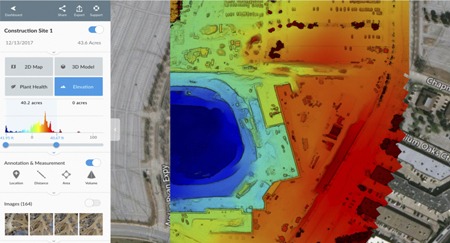
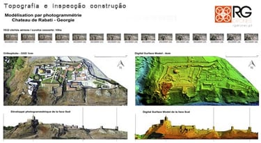
Drones are now used in construction for topography, terrain mapping, distance and area calculation, volume measurement, inspections, recording and construction monitoring. Construction companies are already benefiting from this new tool.
Precision topography
Construction monitoring
Inspection
Promotion
_______________________________________________


01
02
03
PLANNING PHASE:
EXECUTION PHASE:
PROMOTION
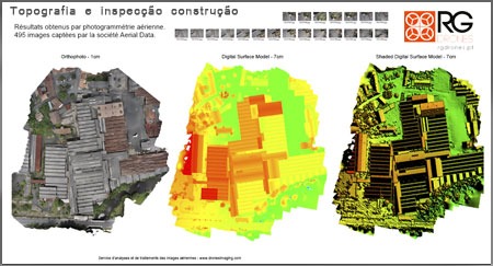
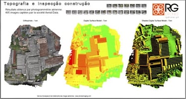
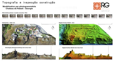
Topography
Mapping
Digital terrain model
Quality control, real-time inspection with video/photo recording.
Quickly and safely accessing hard-to-reach points.
Calculation of extracted and deposited earth volumes.
Construction monitoring and regular video and photo recording updates.
Construction videos and photographs
Construction time-lapse
Marketing and Communication
________________________________________________
________________________________________________
________________________________________________
Quote request
________________________________________________

______________________________________________________________________________________________________________________________________________________________________________________________________________________________________________________________________________________________________________________________________________________
R. Almirante César A C Rodrigues
nº16, 3º ESQ 2790-009 Carnaxide
Lisboa - PORTUGAL
Telf.: +351 962 587 575


RG DRONES © 2010 - Rodrigues e Guimarães Lda.
Terms and Conditions
Privacy Policy
Returns and Refunds Policy