

Precision Topography and Mapping
Advantages of Using Drones for Precision Topography and Mapping

RG Drones
Advantages of Using Drones for
Precision Topography and Mapping
Advantages, efficiency, cost savings and precision.
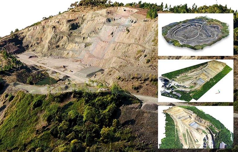
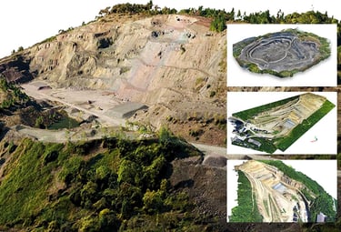
In recent years, drone technology has become a valuable tool for a wide range of applications, and one of the areas that has benefited most from this advancement is precision topography and mapping. Using drones for these purposes offers numerous advantages, making the process more efficient, cost-effective and precise.
Below, we present a list of the main advantages of using drones for precision topography and mapping:
1. Efficiency and Speed:
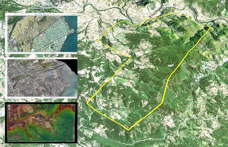
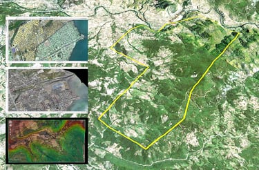
Drones are capable of covering large areas in a short space of time, speeding up the topographic data collection and mapping process.
2. Cost Reduction:
The use of drones eliminates the need for expensive equipment and extensive labour, significantly reducing the costs of topographic data acquisition.
3. Detail Precision:
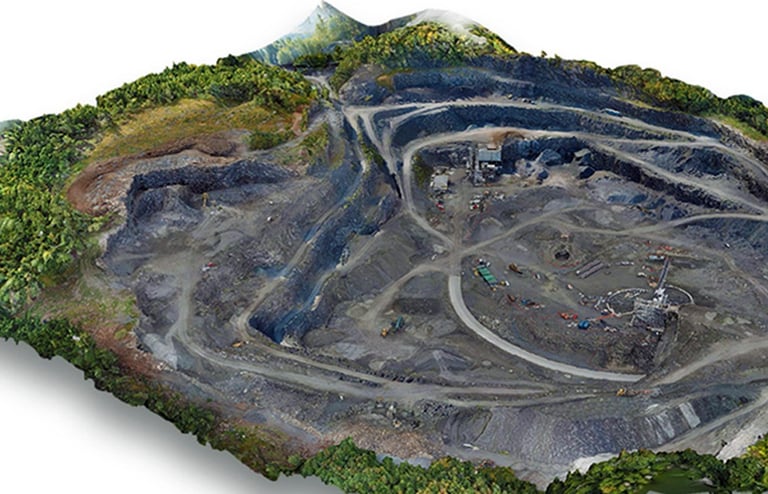
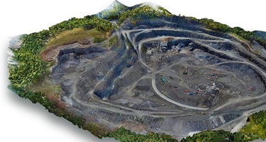
Drones equipped with high-resolution cameras and precise sensors capture detailed, high-definition information, enabling the generation of accurate maps.
4. Accessibility to Remote Locations:
Drones can access hard-to-reach or dangerous areas, such as steep slopes, dense forests and locations inaccessible by land.
5. Real-Time Monitoring:
The ability to transmit data in real time allows operators to monitor the progress of data collection and make immediate decisions.
6. Safety:
Data collection by drone eliminates the risk of accidents for operators who would otherwise be involved in hazardous tasks and terrain.
7. Flexibility and Adaptability:
Drones can be easily configured to meet different needs, from topographic land surveys to mapping of buildings and urban areas.
8. Data Integration:
Data captured by drones can be easily integrated into geographic information systems (GIS), facilitating analysis and report generation.
9. Environmental Sustainability:
The use of drones in topography and mapping contributes to reducing the environmental footprint, as it eliminates the need for motorised vehicles and reduces pollutant emissions.
10. Multidisciplinary Applications:
Beyond topography and mapping, drones are used in precision agriculture, natural disaster monitoring, urban planning, and much more.
In summary, the use of drones for precision topography and mapping offers a range of advantages, from cost savings to the efficient acquisition of highly accurate data. With the constant advancement of technology, the integration of drones into these processes will continue to expand and improve, providing increasingly sophisticated solutions for a wide variety of applications.

______________________________________________________________________________________________________________________________________________________________________________________________________________________________________________________________________________________________________________________________________________________
R. Almirante César A C Rodrigues
nº16, 3º ESQ 2790-009 Carnaxide
Lisboa - PORTUGAL
Telf.: +351 962 587 575
RG DRONES © 2010 - Rodrigues e Guimarães Lda.
Terms and Conditions
Privacy Policy
Returns and Refunds Policy